Chester Rd Planning Application Withdrawn
Hazel Grove Ward Liberal Democrats
Standing up for Hazel Grove All Year Round Learn more
Roads Investment Big Bang
Remembrance done differently this year.
Chester Rd Planning Application Withdrawn
Roads Investment Big Bang
Remembrance done differently this year.
How Much of Stockport is Built On?
by jontwigge on 13 November, 2017
The BBC has a handy tool that allows you to look at any part of the UK and see how much of it is built on – and compare that to the national average. It would be great to look down in more detail to see Hazel Grove but the tool only goes to the Stockport level which is still fascinating to see.
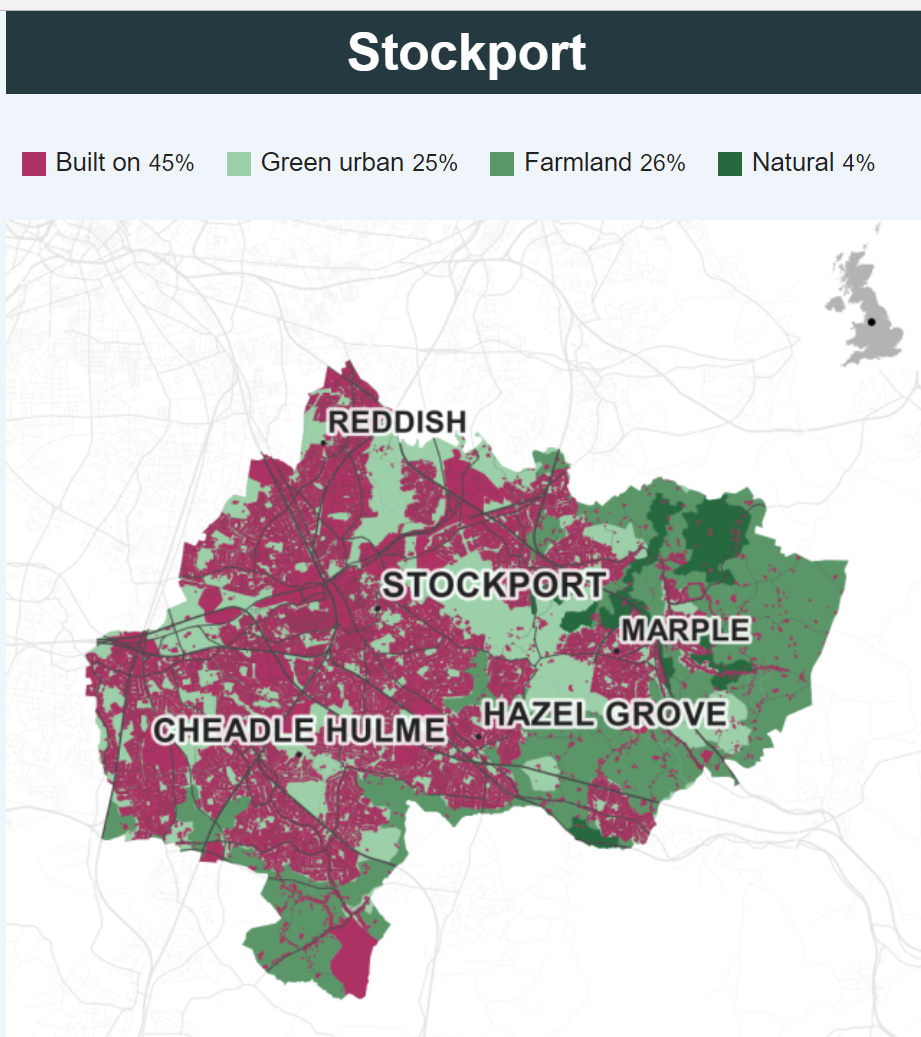
As Stockport is mostly urban, it’s no surprise that we are more built-on than the average (which will include all the rural areas), nor that we have rather less farmland and natural land. Manchester, by comparison, is 67% built, while Cheshire East is just 8% built. (Cheshire East is mostly farmland – 83% – and has little more natural land than Stockport).

With Stockport planning housing for the next twenty years, Cllr Iain Roberts, a previous leader of Stockport Lib Dems said “There is a huge amount of derelict, unused and under-used brownfield land, especially in Stockport itself. The challenge is to unlock it and make the finance stack up to bring forward development. It ranges from the mess that’s Knightbridge (between the Peel Centre and the motorway) to under-utililised land, like single storey workshops around the town centre. If we focus building around transport hubs we’ll also minimise the effects on the roads. It’s not easy though. The easier option is always to say ‘let’s build on those fields and worry about the cars and pollution later’, as Cheshire East have done.”
Killer fact from the Beeb: the amount of land covered by buildings in Britain is less than the amount of land revealed when the tide goes out!
From the BBC story – Five Mind Blowing Facts About What the UK Looks Like
Leave a comment
Leave a Reply