Chester Rd Planning Application Withdrawn
Hazel Grove Ward Liberal Democrats
Standing up for Hazel Grove All Year Round Learn more
Roads Investment Big Bang
Remembrance done differently this year.
Chester Rd Planning Application Withdrawn
Roads Investment Big Bang
Remembrance done differently this year.
See Crime Levels In Your Postcode Area
by jontwigge on 30 August, 2016
The Manchester Evening News has brought out a nice tool that allows you to compare crime in your postcode area to the rest of the country – you can try it here.
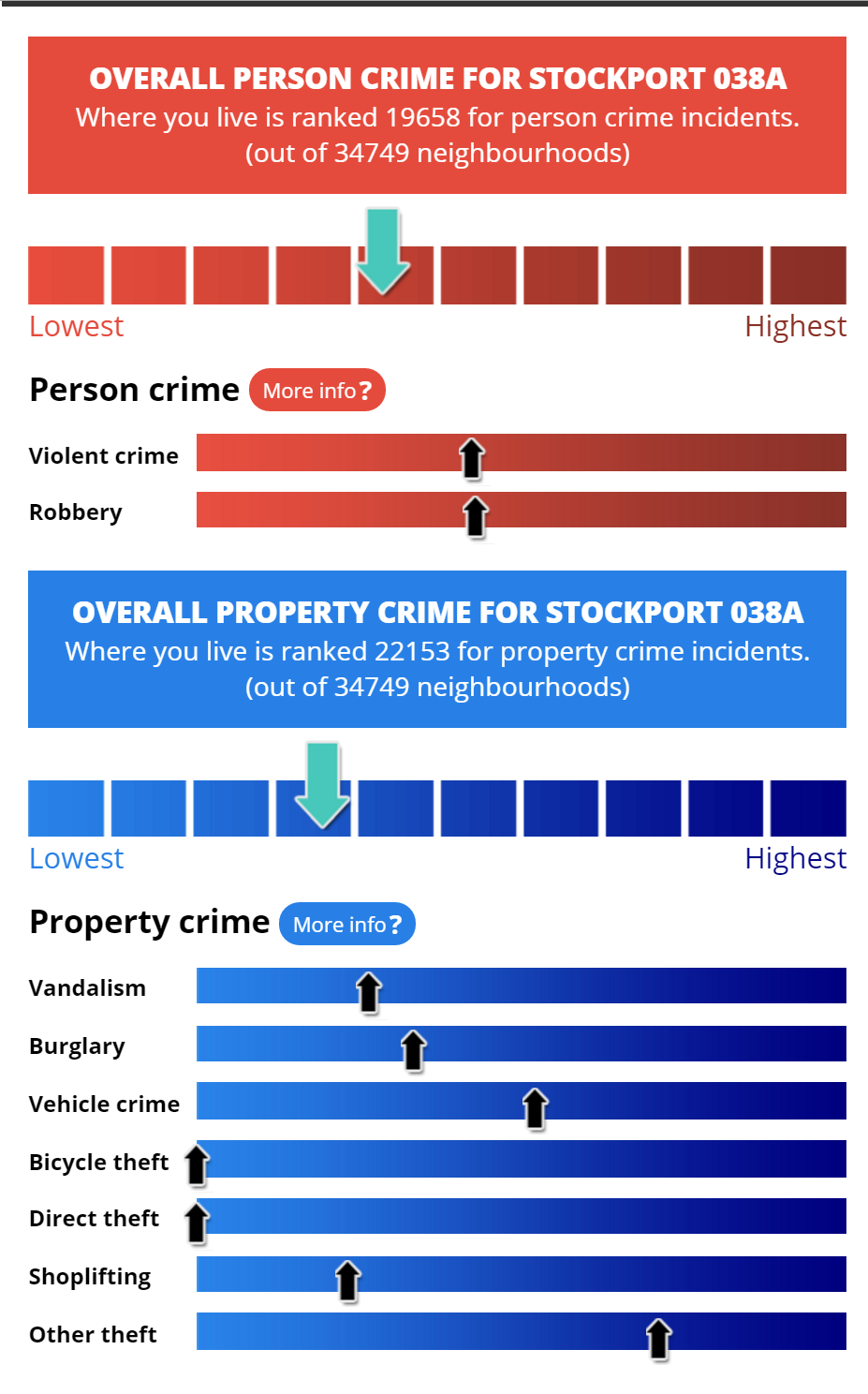
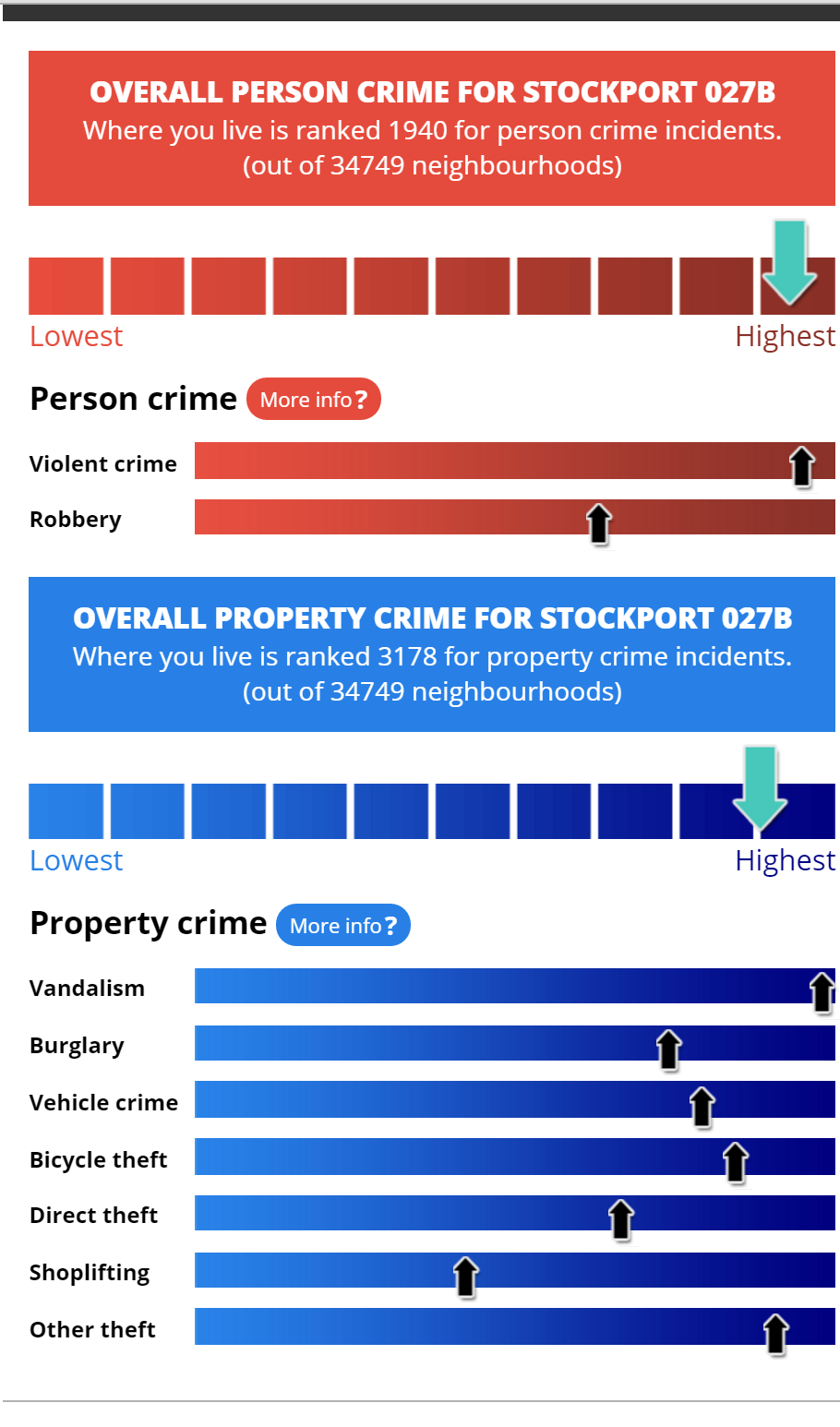
Here are two examples from either end of the A6 in Hazel Grove:
Simpsons Corner, near the start of the new road to the airport:
Around Stepping Hill Hospital:
What are the areas?
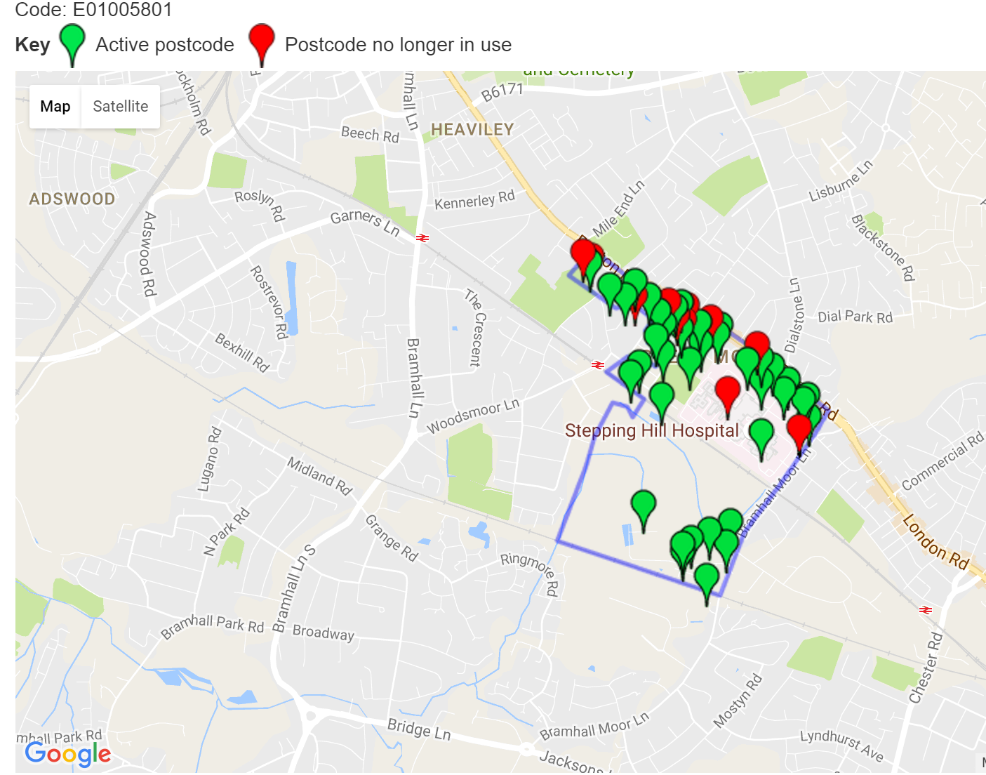
When you get crime figures like this, it’s not the figures for your road but for the area around it. It’s based on something called a Local layer Super Output Area – which is used by Government statisticians.
Say you want to know what the hospital area covers – that’s given on the MEN website as “Stockport 027B”. So you can Google “Stockport 027B LSOA” and there’s a site called doogal.co.uk which will show you a map that looks something like this.
Leave a comment
Leave a Reply